Nueva Geografía Universal Map (1879): A Historical Cartographic Gem
- Nueva Geografía Universal Map (1879): A Historical Cartographic Gem & Details
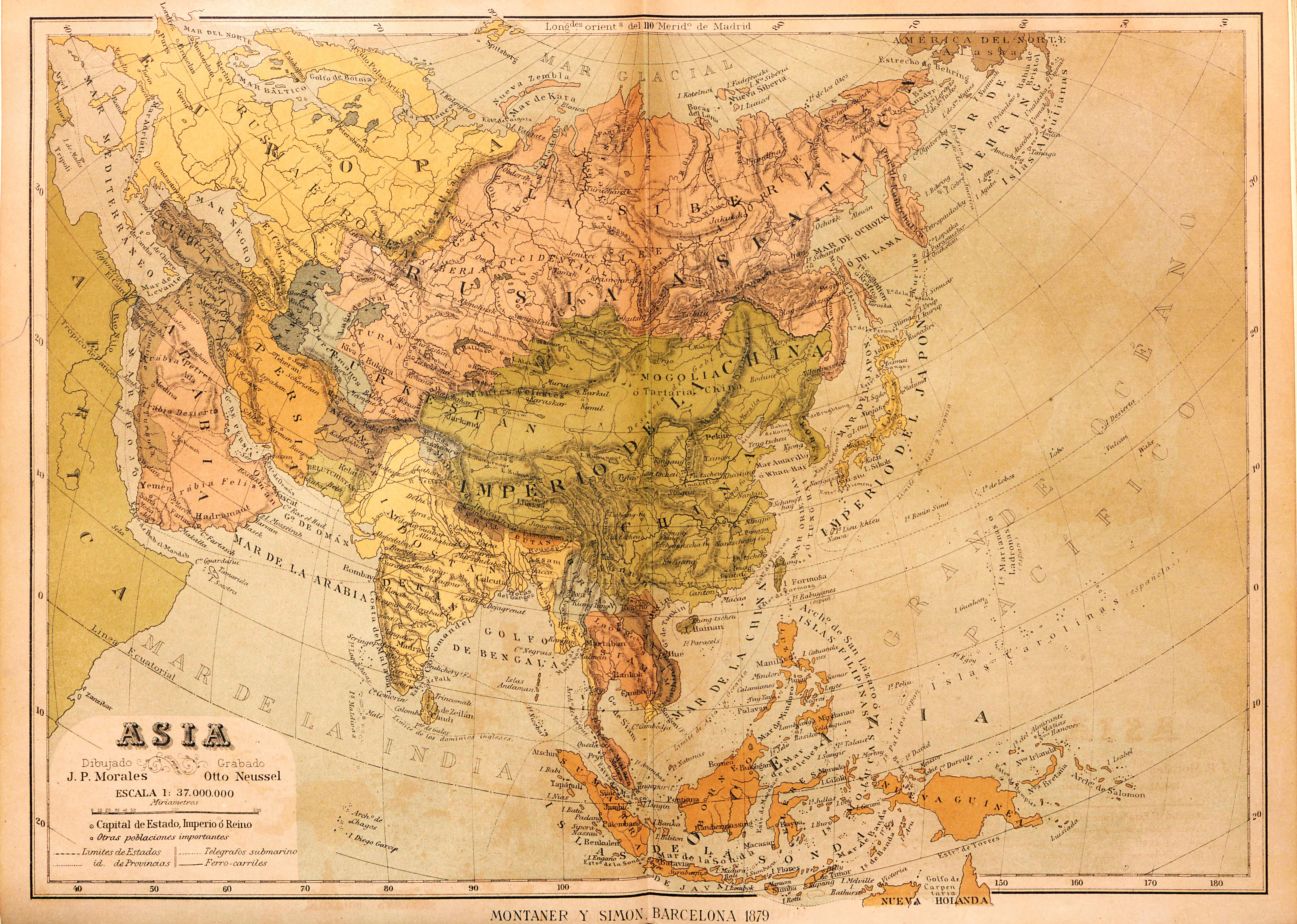
- The Nueva Geografía Universal Map of 1879 stands as a captivating relic of 19th-century cartography, offering a glimpse into the world as perceived during that era. Crafted with meticulous detail, this map is a testament to the dedication and precision of its cartographers.
- The year 1879 marked a period of significant global exploration and geopolitical changes, and this map reflects the state of knowledge at the time. From the delineation of continents to the intricate mapping of geographical features, the Nueva Geografía Universal Map is a visual journey through an age of discovery. Its historical significance is not only rooted in its accuracy but also in its role as a cultural artifact, providing valuable insights into the perspectives and priorities of the late 19th century.
- Exploring this map is like stepping into the past, where the boundaries of empires and the contours of uncharted territories unfold with each carefully drawn detail.