October 18, 2024, 11:12 am

Search Map

Discovering Old Antique Map of London


  • Discovering London's History: Vintage Map of London Reveals the Past
     
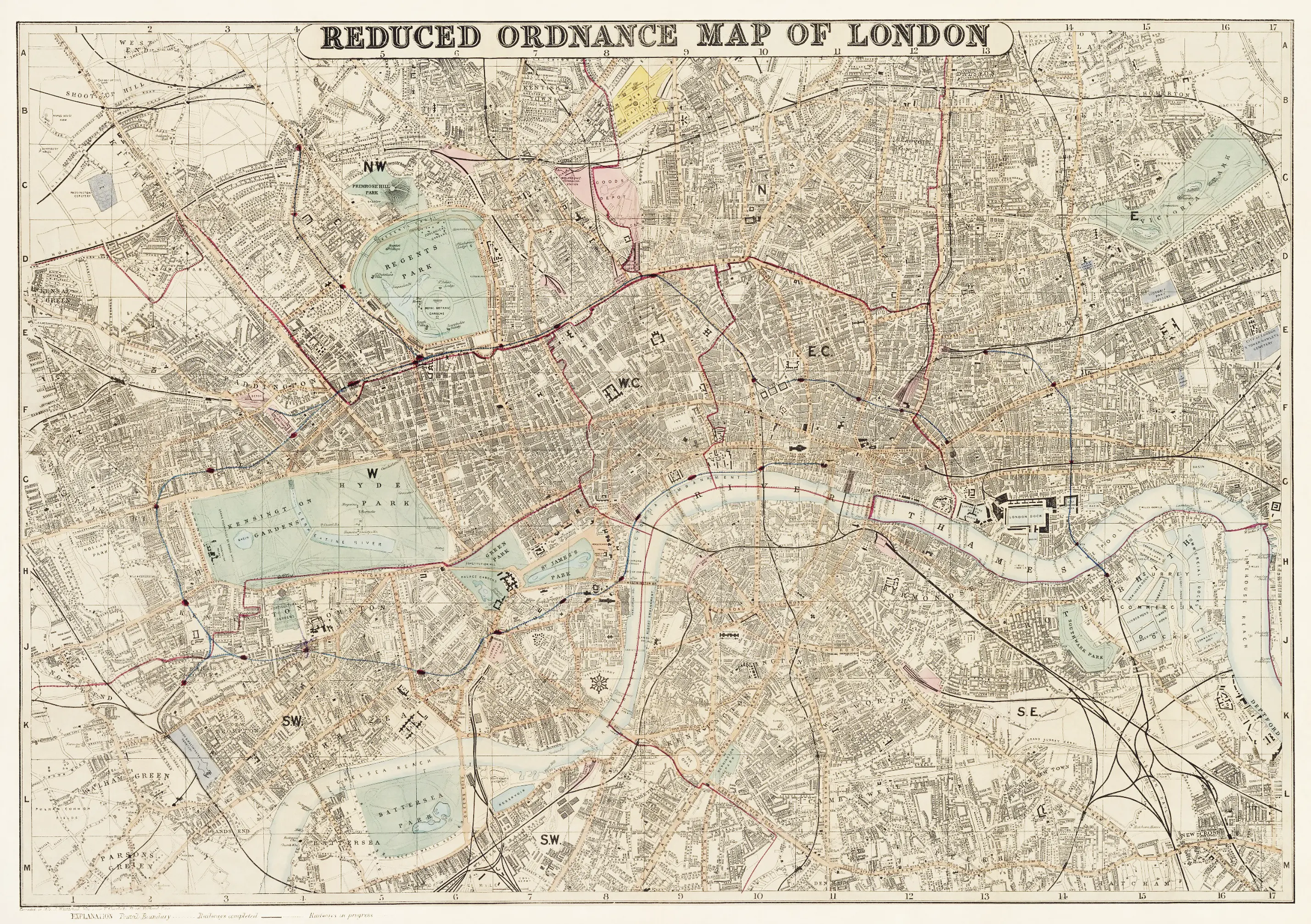
  • Embark on a captivating journey through time with our Vintage Map of London, a unique glimpse into the city's rich history. This meticulously preserved map invites you to explore the bygone streets and landmarks that have shaped London over the years.
     
  • Uncover the charm of historical neighborhoods, iconic structures, and forgotten corners, all captured in exquisite detail. Perfect for history enthusiasts, this Old Map of London serves as a portal to a different era, allowing you to trace the evolution of this iconic city.
     
  • Immerse yourself in the nostalgia of centuries past and gain a deeper understanding of London's vibrant heritage. Let this vintage gem be your guide as you navigate the streets and stories of historic London.


Nostalgic Charm Unveiled: Explore the Fine Amos & Andy Promotional Map of Weber City with Original Letter and Envelope

  • Exploring Nostalgia: Amos & Andy's Mythical Weber City Revealed in a Vintage Promotional Map


  • A fine example of cultural nostalgia comes to life through the Amos & Andy promotional map, showcasing their mythical town of Weber City. This vintage gem provides a charming glimpse into the fictional world created by the...


    View More

Antique Map of Asia: Exploring Ancient Cartography with Insights into Africa, Europe, and Polynesia

  • Old Map of Asia: A Pictorial Journey Across Continents


  • This venerable map of Asia, a true relic of the past, unfurls a captivating narrative that transcends the boundaries of the Asian continent. Crafted with precision and artistry, this antique map not only delineates the geographical features of Asia but also extends...


    View More

The German Hemisphere Map of The East From 1903

  • The German Hemisphere Map of the East from 1903 stands as a significant cartographic artifact.


  • Offering a glimpse into the geopolitical landscape of the early 20th century. Crafted with precision and detail, this map reflects Germany's interest and engagement with the Eastern Hemisphere during a period marked by geopolitical shifts and...


    View More

Colton Map of Asia 1855, The Great Wall and the Great Canal in China

  • Colton Map of Asia 1855 The Map shows Both The Great Wall and the Great Canal in China.


  • The Colton Map of Asia from 1855 is a remarkable cartographic work that provides a detailed and historically significant representation of the continent during the mid-19th century. Notably, this map stands out for...


    View More

Exploring Earth's Depths: Geology-Chart Vintage Poster Reveals Geological Marvels with Earth’s Core, Surface Model, and Striking Volcano Illustration

  • Geology Chart - Unveiling Earth's Geological Wonders
     
  • "Geology Chart" presents a captivating journey through time with a vintage educational poster that unveils the intricate model of the Earth's core and surface. This beautifully illustrated chart not only delves into the geological layers that compose our planet but also highlights the...


    View More

1827 Map of Asia and Australia - Featuring Australia (New Holland) and East India Islands From the 19th Century

  • 1827 Map of Asia and Australia - Featuring Australia (New Holland)  from the 19th Century.


  • The Finley Map of Asia and Australia from 1827 is a remarkable cartographic representation that encapsulates the geographical knowledge of the time. In keeping with the conventions of 19th-century maps, this intricate depiction encompasses Australia, then referred...


    View More
WhatsApp