September 8, 2024, 6:48 am

Search Map

Antique Map of Asia: Exploring Ancient Cartography with Insights into Africa, Europe, and Polynesia


  • Old Map of Asia: A Pictorial Journey Across Continents


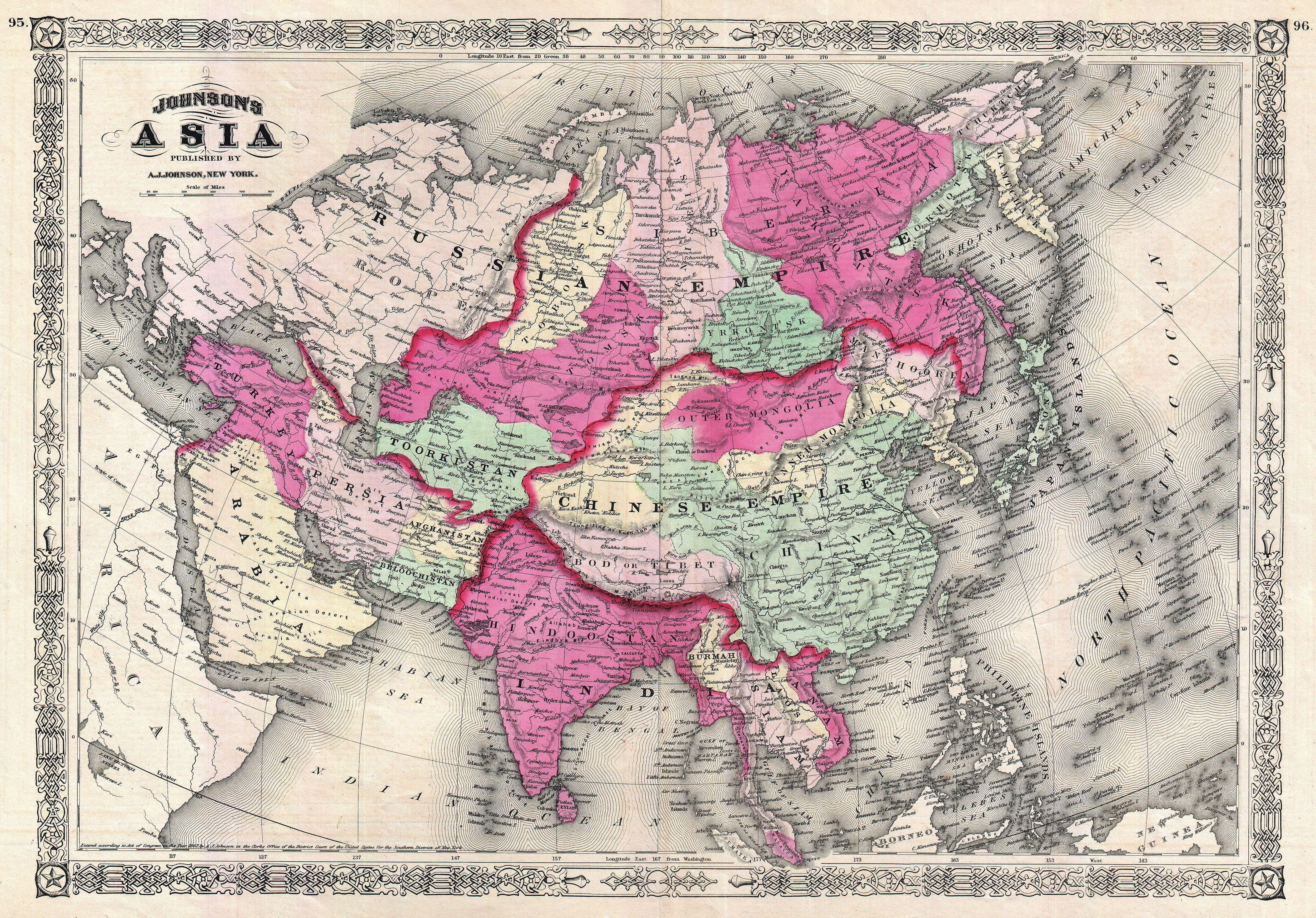
  • This venerable map of Asia, a true relic of the past, unfurls a captivating narrative that transcends the boundaries of the Asian continent. Crafted with precision and artistry, this antique map not only delineates the geographical features of Asia but also extends its reach to include glimpses of Africa, Europe, and Polynesia. The intricate details on this map paint a vivid picture of a bygone era, where exploration and cartography intersected to create a visual symphony of interconnected continents.
     
  • The inclusion of parts of Africa, Europe, and Polynesia adds a layer of complexity, highlighting the interconnectedness of these regions in the historical imagination. As one delves into the faded lines and faded hues, it becomes a journey through time, revealing the cartographic marvels that once guided the wayfarers of yesteryears across the diverse landscapes of Asia and beyond.


Discovering Diversity: 19th Century Anglocentric Climatic Chart - A Vibrant World Map with Intriguing Human Illustrations

  • A Chromatic Tapestry: Navigating the 19th Century Anglocentric Climatic Chart


  • Embark on a visual odyssey through the pages of the 19th Century Anglocentric Climatic Chart, a delightful world map adorned with a pleasing array of colors and intriguing depictions of humanity along its lower edge. This captivating cartographic gem offers a...


    View More

Map of Far East Australia, Indian Ocean Eastern Africa, India Asia, East Indies, And Australia

  • The Antique Map of Far East Australia: A Glimpse into Maritime Splendor and Cultural Riches


  • A captivating cartographic masterpiece, the Antique Map of Far East Australia unveils a panorama of the Indian Ocean and the enchanting coastlines of eastern Africa, India, Asia, the East Indies, and Australia. Richly adorned with intricate...


    View More

Bartholomews General Map of Asia.2, 1940

  • Bartholomews general map of Asia.2 - 1940
     
  • Bartholomew's General Map of Asia (1940) is a historical cartographic marvel that provides a comprehensive snapshot of the Asian continent during a pivotal period. Crafted against the backdrop of World War II, the map reflects the geopolitical intricacies and uncertainties of the time....


    View More

Charting Earth's Diversity: Geographical-Definitions-Illustrated-lg, Unveiling Nature's Tapestry and Human Ingenuity

  • The Geographical Definitions Illustrated LG 
     
  • 1. Explore a wide range of definitions for various natural landscape features, coastal formations, and urban geographical elements through illustrated examples.


  • 2. Delve into the definitions of diverse natural landscape features, coastal formations, and man-made geographical elements, all accompanied by visual illustrations.


Exploring Earth's Depths: Geology-Chart Vintage Poster Reveals Geological Marvels with Earth’s Core, Surface Model, and Striking Volcano Illustration

  • Geology Chart - Unveiling Earth's Geological Wonders
     
  • "Geology Chart" presents a captivating journey through time with a vintage educational poster that unveils the intricate model of the Earth's core and surface. This beautifully illustrated chart not only delves into the geological layers that compose our planet but also highlights the...


    View More

Discover Earth's Majesty: Ascending Order Geography Chart Featuring Major Mountains and Cities Across Continents

  • Nature's Grandeur Mapped: Ascending Order Geography Chart Reveals Majestic Mountains Across Continents
     
  • Embark on a visual odyssey through the "View of Nature in Ascending Order" geography chart by exploring the majesty of the world's continents and their towering peaks. This meticulously crafted chart showcases the major mountains in ascending order,...


    View More
WhatsApp