Imperial Federation Map of The World British Empire in 1886
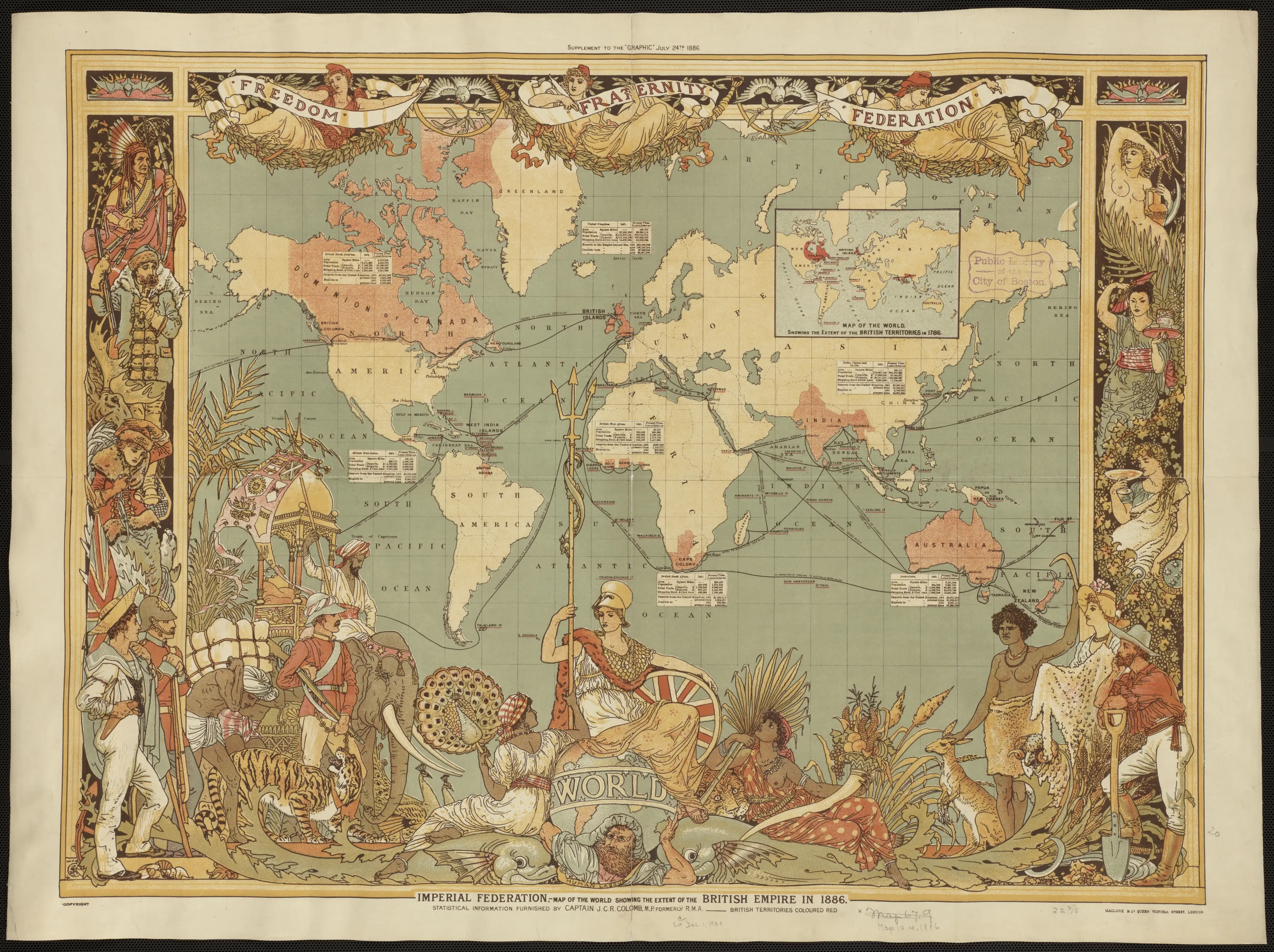
- The World British Empire in 1886
- The concept of Imperial Federation gained prominence in the late 19th century as a proposal to strengthen the bonds within the British Empire. Concurrently, the Map of the World depicting the British Empire in 1886 serves as a visual testament to the extent and diversity of imperial holdings during that era.
- This cartographic representation not only delineates the territorial expanse of the British Empire but also embodies the imperial aspirations and geopolitical dynamics of the time. The year 1886 places this map amidst discussions on Imperial Federation, a vision that envisioned closer political and economic ties between Britain and its colonies.
- The map likely showcases the vastness of British dominion, from the colonies in Africa and Asia to territories in the Americas and the Pacific. It serves as a historical artifact, encapsulating the imperialistic ambitions of the British Empire during the late 19th century and providing valuable insights into the geopolitical landscape of the time.