October 18, 2024, 11:04 am

Search Map

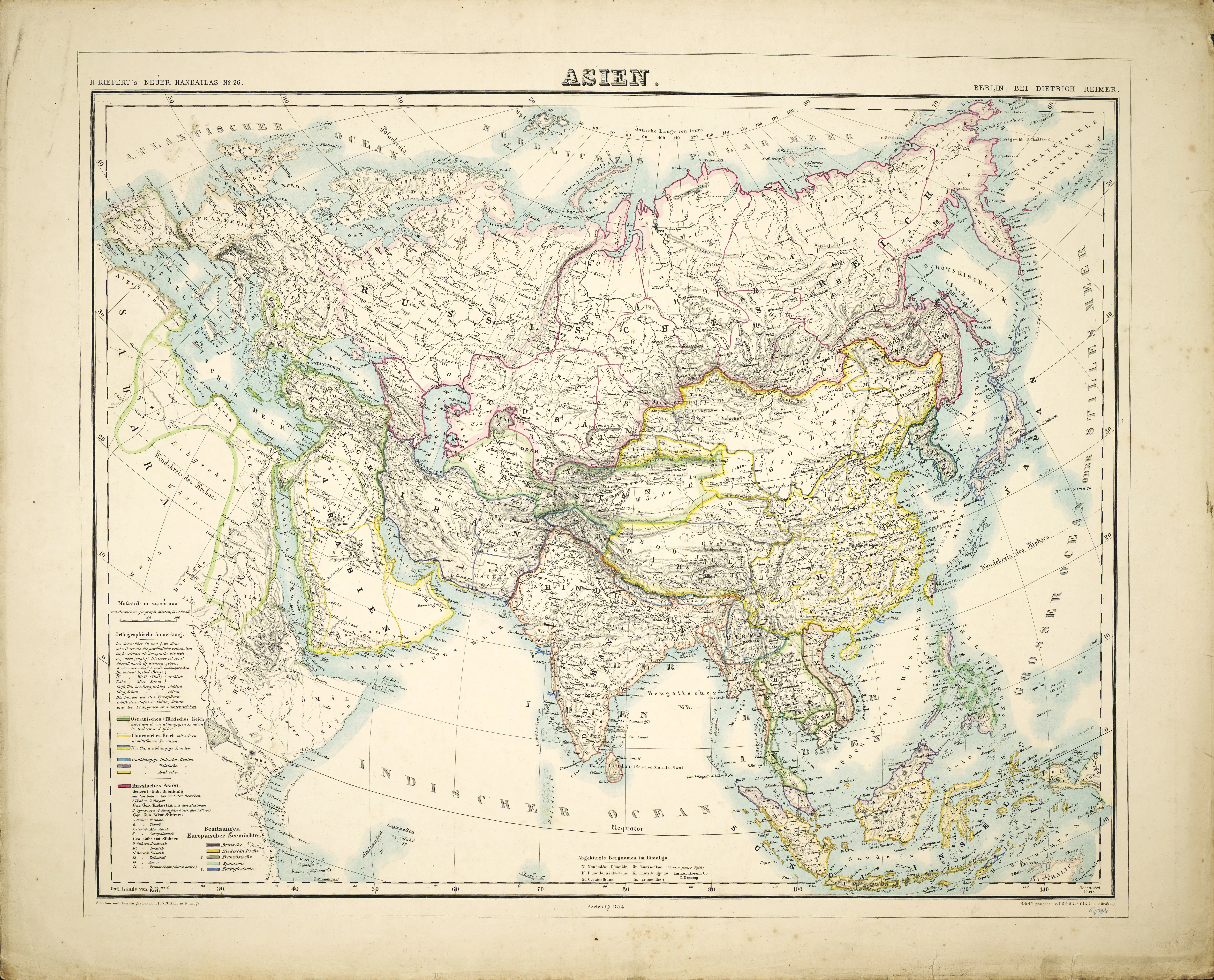
A Dutch Map of The Asian Continent From 1874


  • Charting the Unknown: A Dutch Map of the Asian Continent (1874)
     
  • Step into the past with our exclusive Dutch Map of the Asian Continent from 1874, a historical cartographic gem that unveils the complexities of the continent during the 19th century. Crafted with precision by Dutch cartographers, this map offers a unique perspective on the geopolitical landscape, capturing the intricacies of political boundaries, colonial territories, and cultural diversity.


  • The meticulous detailing and artistic craftsmanship reflect the Dutch exploration and influence in Asia during this era, providing a vivid portrayal of the region's historical dynamics. Navigate through the contours of nations and territories, discovering the Dutch interpretation of the Asian continent in 1874. Whether you're a history enthusiast, a collector of vintage maps, or simply curious about the past, this map serves as a captivating portal to a bygone era.
     
  • Offering valuable insights into the geopolitical and cultural intricacies that shaped Asia in the late 19th century. Join us in exploring the stories embedded in this Dutch Map, as we invite you to witness the nuanced perspectives of a pivotal chapter in Asian history.


Discover Earth's Majesty: Ascending Order Geography Chart Featuring Major Mountains and Cities Across Continents

  • Nature's Grandeur Mapped: Ascending Order Geography Chart Reveals Majestic Mountains Across Continents
     
  • Embark on a visual odyssey through the "View of Nature in Ascending Order" geography chart by exploring the majesty of the world's continents and their towering peaks. This meticulously crafted chart showcases the major mountains in ascending order,...


    View More

A Chart Map of The Easternmost East India And China

  • Navigating the East: A Chart Map of the Easternmost Part of East India and China
     
  • Embark on a historical voyage with our extraordinary Chart Map of the Easternmost East India and China, a navigational gem that unveils the maritime intricacies of the 18th century. Crafted with meticulous detail and accuracy,...


    View More

Asia Contenent Map 1853, East Indies and Australia

  • Asia Contenent Map - 1853 - The map covers the entirety of Asia as well as the East Indies and Australia.


  • The Asia Continent Map from 1853 stands as a historical cartographic treasure, encapsulating the vast expanse of the Asian continent along with the East Indies and Australia. This meticulously crafted...


    View More

1827 Map of Asia and Australia - Featuring Australia (New Holland) and East India Islands From the 19th Century

  • 1827 Map of Asia and Australia - Featuring Australia (New Holland)  from the 19th Century.


  • The Finley Map of Asia and Australia from 1827 is a remarkable cartographic representation that encapsulates the geographical knowledge of the time. In keeping with the conventions of 19th-century maps, this intricate depiction encompasses Australia, then referred...


    View More

Discovering Diversity: 19th Century Anglocentric Climatic Chart - A Vibrant World Map with Intriguing Human Illustrations

  • A Chromatic Tapestry: Navigating the 19th Century Anglocentric Climatic Chart


  • Embark on a visual odyssey through the pages of the 19th Century Anglocentric Climatic Chart, a delightful world map adorned with a pleasing array of colors and intriguing depictions of humanity along its lower edge. This captivating cartographic gem offers a...


    View More

Nueva GeografĂ­a Universal Map (1879): A Historical Cartographic Gem

  • Nueva Geografía Universal Map (1879):  A Historical Cartographic Gem & Details


  • The Nueva Geografía Universal Map of 1879 stands as a captivating relic of 19th-century cartography, offering a glimpse into the world as perceived during that era. Crafted with meticulous detail, this map is a testament to the dedication and precision of...


    View More
WhatsApp