September 8, 2024, 6:37 am

Search Map

Colton Map of Asia 1855, The Great Wall and the Great Canal in China


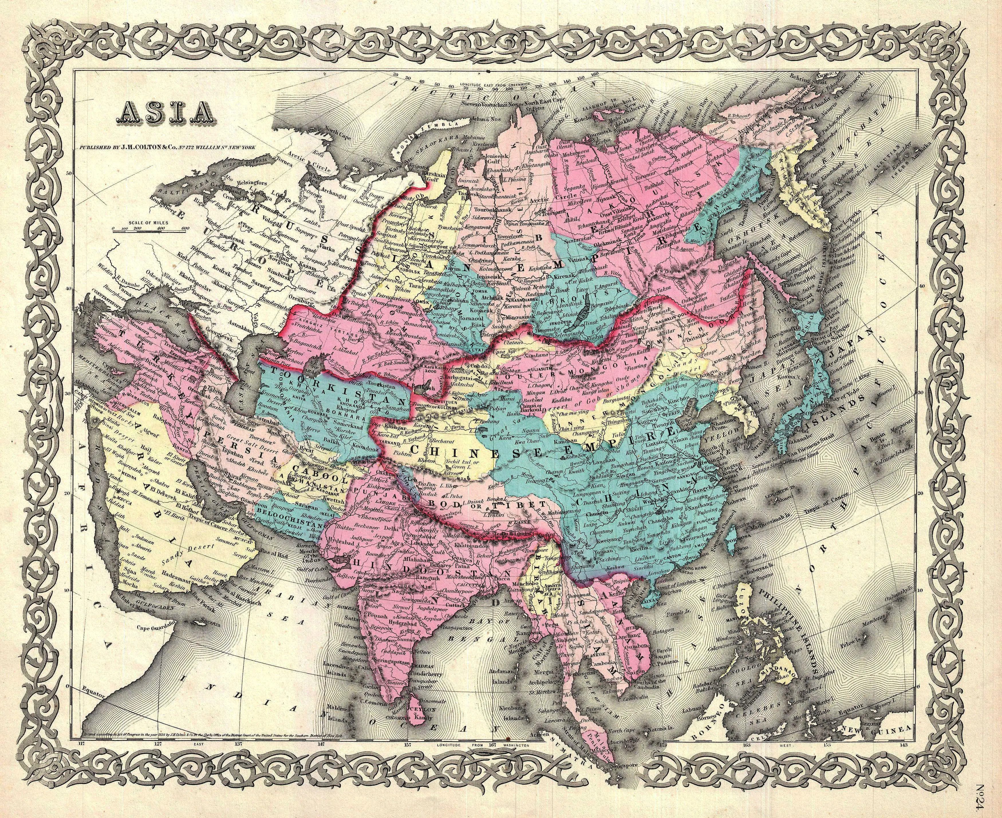
  • Colton Map of Asia 1855 The Map shows Both The Great Wall and the Great Canal in China.


  • The Colton Map of Asia from 1855 is a remarkable cartographic work that provides a detailed and historically significant representation of the continent during the mid-19th century. Notably, this map stands out for its inclusion of key landmarks such as the Great Wall and the Great Canal in China. The depiction of the Great Wall reflects its strategic importance as a monumental defensive structure, offering insights into China's historical efforts to safeguard its northern borders.


  • Simultaneously, the portrayal of the Great Canal underscores the significance of ancient engineering marvels, illuminating the extensive network of waterways that facilitated transportation and trade in China. Colton's map thus becomes a valuable resource for understanding not only the geographical features of Asia but also the cultural and strategic elements that shaped the region's history.
     
  • This meticulous representation of both natural and man-made landmarks contributes to the map's significance as a window into the historical, cultural, and geopolitical nuances of Asia in the mid-19th century.


John Cary Map of Asia (1806): Masterpiece of Precision and Detail

  • John Cary Map of Asia (1806): A Cartographic Masterpiece of Precision and Detail


  • The John Cary Map of Asia, crafted in 1806, stands as a remarkable testament to the artistry and precision of cartography during the 19th century. This exquisite map is a true masterpiece, capturing the diverse landscapes of the...


    View More

Asia Contenent Map 1853, East Indies and Australia

  • Asia Contenent Map - 1853 - The map covers the entirety of Asia as well as the East Indies and Australia.


  • The Asia Continent Map from 1853 stands as a historical cartographic treasure, encapsulating the vast expanse of the Asian continent along with the East Indies and Australia. This meticulously crafted...


    View More

Discovering Old Antique Map of London

  • Discovering London's History: Vintage Map of London Reveals the Past
     
  • Embark on a captivating journey through time with our Vintage Map of London, a unique glimpse into the city's rich history. This meticulously preserved map invites you to explore the bygone streets and landmarks that have shaped London over the...


    View More

Map of Far East Australia, Indian Ocean Eastern Africa, India Asia, East Indies, And Australia

  • The Antique Map of Far East Australia: A Glimpse into Maritime Splendor and Cultural Riches


  • A captivating cartographic masterpiece, the Antique Map of Far East Australia unveils a panorama of the Indian Ocean and the enchanting coastlines of eastern Africa, India, Asia, the East Indies, and Australia. Richly adorned with intricate...


    View More

Dive into Depths: Descending Order Geography Chart Unveiling Exquisite Sea Life in the Pacific, Atlantic, and Indian Oceans

  • Exploring Oceanic Depths: View of Nature in Descending Order – Geography Chart
     
  • Delve into the mesmerizing world beneath the waves with the "View of Nature in Descending Order" geography chart, a vibrant color print that captures the marine wonders of the Pacific Ocean, Atlantic Ocean, and the Indian Ocean. This...


    View More

Map of Asia: Explore the Near and Middle East, Russia, India, China, Japan, and More with Detailed Mapping of Korea and Japan

  • Exploring the Past: Old Map of Asia Unveils a Tapestry of Far-Reaching Lands


  • Dive into the intricate details of an antique treasure with our Old Map of Asia, a captivating cartographic journey that unfolds the landscapes of the Near and Middle East, Russia, India, China, Japan, Southeast Asia, the East Indies,...


    View More
WhatsApp