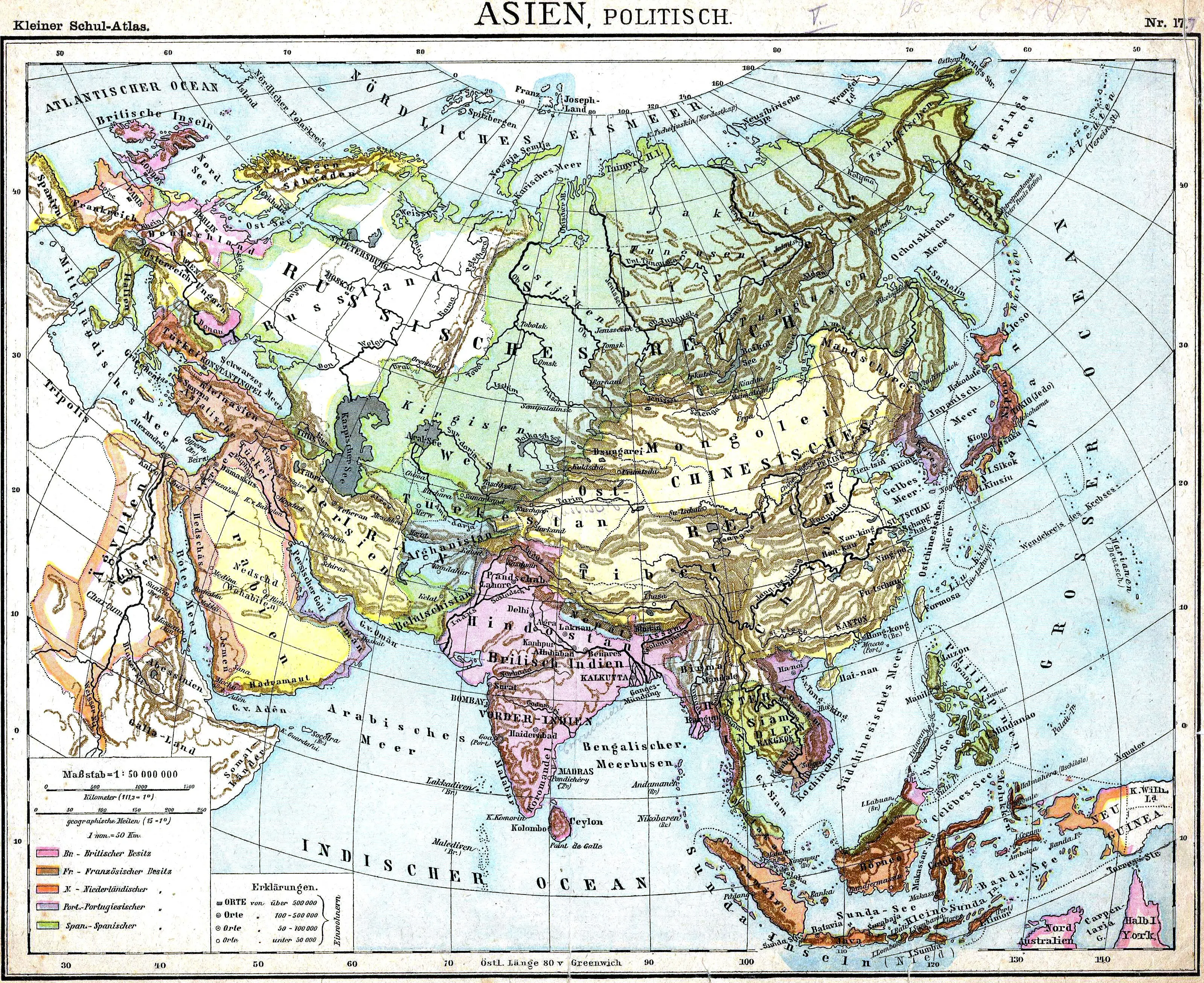
A Dutch Colorful Political Map of Asia From 1899
- A Canvas of Diversity: Dutch Colorful Political Map of Asia (1899)
- Welcome to a visual journey through time with our captivating Dutch Colorful Political Map of Asia from 1899. Crafted with meticulous detail, this vintage cartographic masterpiece invites you to explore the geopolitical landscape of Asia during the turn of the 20th century through the lens of Dutch artistry. The vibrant and intricate colors bring to life the political boundaries, colonial territories, and the diverse cultures that defined Asia during this fascinating period.
- Immerse yourself in the rich tapestry of nations, kingdoms, and regions, each stroke of color reflecting the complex web of historical relationships and geopolitical dynamics. Whether you are a history enthusiast, a cartography aficionado, or someone simply curious about the past.
- This map serves as a vibrant window into the colonial era, providing insights into the Dutch perspective on the political complexities of Asia in 1899. Join us in rediscovering this visual treasure and unravel the stories that lie within the folds of this Dutch Colorful Political Map of Asia from a bygone era.